Atlantic salt meadows
Salt marshes develop between the mean high and low water marks in areas of soft sediments (mud or fine sand) that are relatively sheltered from wave action. Saltmarsh vegetation has to be salt-tolerant (halophytic) in order to survive being covered by the tides. Tolerance to salt water creates zonation of different plant communities in the salt marsh. Those plants nearer low water need to be more tolerant of salt water, as they spend longer being covered by the tide.
Atlantic salt meadows form the middle and upper reaches of salt marshes, where the vegetation is still covered by the tide but less often and for shorter times. The Atlantic salt meadows feature, also known as saltmarsh, in Carmarthen Bay and Estuaries SAC includes saltmarshes from the Burry Inlet, Loughor and the Three Rivers estuaries.
The Carmarthen Bay and Estuaries SAC includes the largest expanse of saltmarsh in Wales. The total extent of saltmarsh was measured as 2914.41 ha in 2020-2021 by NRW. The largest area of Atlantic Salt Meadows is in the Burry inlet between Llanrhidian and Landimore, followed by Penclawdd and the Loughor estuary. In the Three Rivers complex the Gwendraeth estuary has the largest area of Atlantic salt meadows followed by the Taf estuary and then the Tywi estuary.
The extensive saltmarshes of the Carmarthen Bay estuaries have a complete sequence of saltmarsh vegetation, from pioneer vegetation through to upper saltmarsh transitions. The area is also important for transitions from saltmarsh to sand dune and to freshwater and terrestrial vegetation. These are important features of the local saltmarshes and of great biodiversity value.
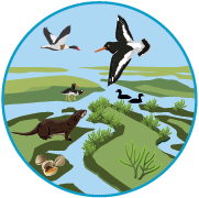
Saltmarshes are an important resource for wading birds and wildfowl. They act as high tide refuges for birds feeding on adjacent mudflats, as breeding sites for waders, gulls and terns and as a source of food for passerine birds particularly in autumn and winter. In winter, grazed saltmarshes are used as feeding grounds by large flocks of wild ducks and geese.
")